

TL;DR:
- Community websites must provide organized, current data on available sites, workforce, and incentives to be competitive in site selection. Clear information, including downloadable site sheets, GIS maps, and direct contacts, influences a community's chances of being shortlisted. Small communities can establish credibility quickly with simple updates and free tools, with expert support available for more advanced website features.
Your community website is the first due-diligence tool a site selector uses — and if the data they need isn't there, organized and current, your community gets screened out before anyone picks up the phone. Site selectors are consultants hired by corporations to compare locations under real time pressure. They run repeatable evaluation processes across dozens of markets simultaneously. Clarity and comparability aren't nice extras — they're the price of admission.
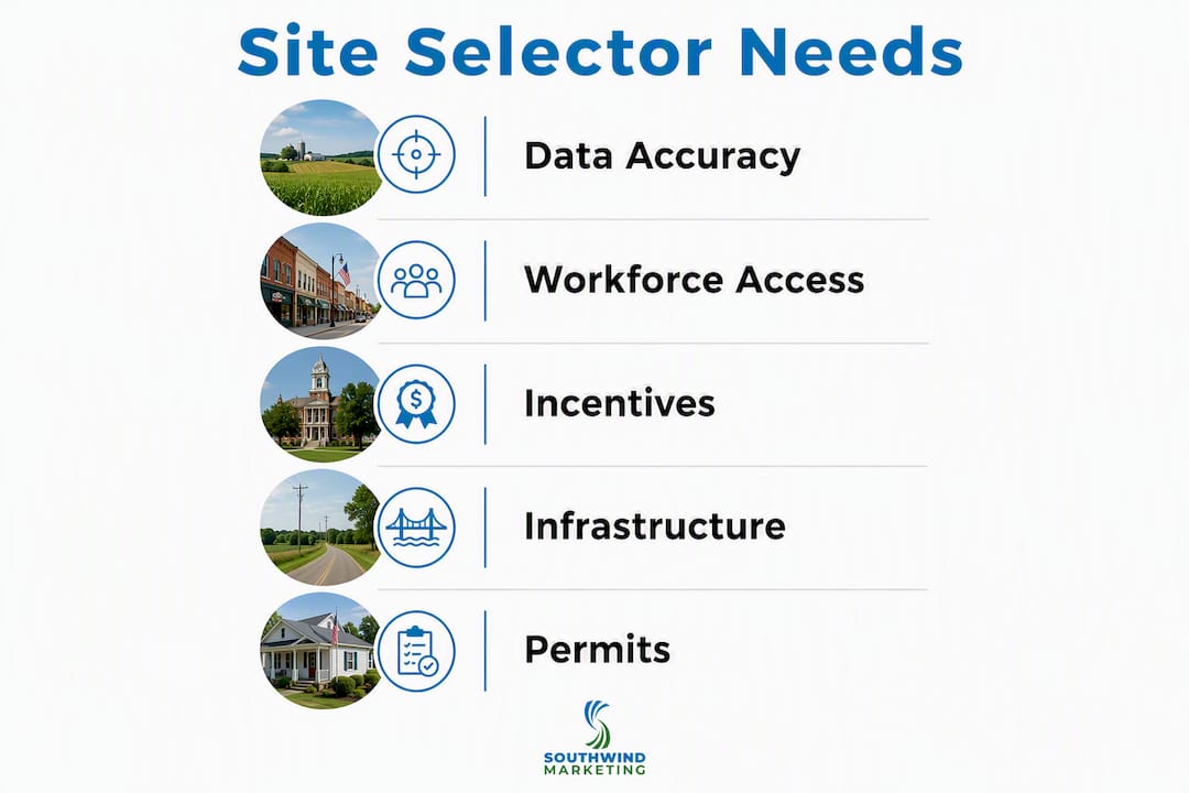
Here's what site selectors scan for first on an economic development website:
- Searchable site and building inventory with acreage, zoning, and asking price
- Site control: who owns the property and what type of control exists
- Workforce data linked directly to each site listing
- Infrastructure capacities: power, water, sewer, gas, and broadband
- Incentive programs with eligibility and a named contact
- Permitting and zoning status, including shovel-ready designation
- Downloadable site sheets and GIS/parcel maps
- A single named point of contact with direct phone and email
Three updates most teams can make within a day: publish a one-page site sheet for your top available property, add a "last verified" date to every data field, and replace a generic contact form with a named staff member's direct line. Those three changes alone move you from invisible to credible.
Table of Contents
- What should every available site listing include?
- What workforce data do site selectors actually need?
- How should you present incentives and cost-of-doing-business data?
- Which infrastructure numbers do selectors check first?
- What zoning and permitting details reduce schedule risk for selectors?
- How should your website present data so selectors can find and trust it?
- How should your contact process work for site selector inquiries?
- How can a small EDO publish selector-ready data on a limited budget?
- How Southwind Marketing helps EDOs build site-selector-ready websites
- Key Takeaways
- The data is the pitch
- Your EDO website can work harder for site selectors
- Useful sources
- FAQ
What should every available site listing include?
Site selectors expect organized, easily accessible data on every listing — not a paragraph of marketing copy, but structured fields they can compare across communities. Silence on pricing or ownership is often read as disorganization or a sign of underlying problems, not discretion.
Every site or building listing should publish these fields:
| Field | What to Include |
|---|---|
| Total acreage | Gross and usable/developable acres |
| Parcel boundaries | GIS shapefile or embedded map with parcel overlay |
| Zoning classification | District name, allowable uses, link to ordinance |
| Site control | Owner name, nature of control (option, ownership, lease) |
| Asking price | Dollar amount or defensible range; see pro tip below |
| Utilities access | Provider names, connection point, available capacity |
| Topography | Slope, grading needs, wetlands/floodplain status |
| Environmental | Brownfield designation, Phase I availability |
| Transportation | Miles to nearest interstate interchange, Class I rail, regional airport |
| Last verified | Date of most recent data confirmation |
Attach a print-ready PDF site sheet to every listing. A selector evaluating ten communities will download all ten sheets and compare them offline. If yours isn't there, yours doesn't get compared.
Transparency on site control and pricing is non-negotiable. Publish who controls the property and what type of control exists. Where possible, provide the actual due-diligence documents — Phase I environmental assessments, geotechnical reports, wetlands delineations — or a documented request mechanism for them. That openness is itself a credibility signal separating "ready" from merely "available."
Interactive GIS mapping and a searchable property database are now standard expectations for communities that want to compete seriously. Embed parcel boundaries, utility corridors, floodplain overlays, and rail access on a single map. Link to your zoning map. Static lists increase friction; filterable maps reduce it.
Pro Tip: If you can't publish an asking price, don't leave the field blank. Instead, write "Price available upon request — contact [Name] at [direct phone/email]. NDA available. Typical response within 24 hours." That single line preserves confidentiality while signaling that your team is organized and responsive.
What workforce data do site selectors actually need?
Labor is usually the largest operating cost in a site selection decision. Selectors don't want your city's population count — they want to know whether the right workers exist within a reasonable commute of the specific site.

Lead with labor-shed metrics, not municipal boundaries. A 45-minute drive-time isochrone around your site tells a selector far more than "our county has 28,000 residents." Pair that with occupational employment counts by SOC code for the sectors you're targeting: advanced manufacturing, distribution, food processing, healthcare, or whatever your community's realistic target industries are.
Minimum workforce data fields every site listing should link to:
- Drive-time isochrone map (30, 45, and 60 minutes)
- Occupational employment counts by relevant SOC codes
- Median wages by occupation (Bureau of Labor Statistics data)
- Unemployment rate and labor force participation rate
- Major employers and recent expansions or announcements
- Community college and technical training partners with program names and enrollment capacity
- Links to apprenticeship programs or workforce development contacts
Package this as a one-page downloadable talent summary for each site or project type. A selector evaluating a distribution center project needs different labor data than one evaluating a precision manufacturing facility. Tailor accordingly.
| Workforce Data Field | Recommended Source |
|---|---|
| Drive-time isochrone | Google Maps API, ArcGIS Online, or ESRI |
| Occupational employment | Bureau of Labor Statistics OES data |
| Wage benchmarks | BLS or state workforce agency |
| Training partners | Community college enrollment office |
| Recent placements | State workforce agency or local employer contacts |
A short case study on your site — even one paragraph describing a recent hire ramp-up by a company that located in your community — validates the labor pool in a way that no table can. Real evidence of successful hiring is a credibility signal selectors remember.
How should you present incentives and cost-of-doing-business data?
Selectors expect to find incentive information on your website. When it's missing, they don't assume you have nothing to offer — they assume your team isn't organized enough to publish it, and they move on.
For each incentive program, publish at minimum:
- Program name and administering agency
- Eligibility criteria (industry type, job creation threshold, capital investment minimum)
- Typical award range or benefit description
- Application process and timeline
- Named point of contact with direct phone and email
A one-page downloadable incentive summary card works well here. Format it the same way you format a site sheet: clean, dated, and print-ready. Selectors share these internally with their corporate clients, so presentation matters.
On the cost side, publish your effective property tax rate, major local fees, and sample utility cost ranges. You don't need to publish every line item — a simple table showing how your community compares to state averages on power cost per kWh, water/sewer rates, and effective tax rate gives a selector enough to model preliminary operating costs. Pair that with a link to your state's incentive and site data resources for additional context.
Undisclosed pricing and incentives create friction and skepticism. The communities that win projects are almost always the ones that make cost modeling easy, not the ones that require three phone calls to get a number.
Which infrastructure numbers do selectors check first?
Infrastructure capacity determines whether a project is physically possible on a given site. Selectors check these numbers early in the screening process, often before they contact anyone.
Publish these fields for every site:
- Electric utility provider, available capacity in MW, and distance to nearest substation
- Natural gas provider, line pressure (psi), and nearest connection point
- Water provider, available capacity in MGD, and connection point size
- Sewer provider, available capacity in MGD, and connection point size
- Broadband provider(s), fiber availability, and last-mile status
- Emergency services: fire protection class and nearest station distance
| Infrastructure Field | Unit | What to Publish |
|---|---|---|
| Electric capacity | MW available | Provider, substation distance, available load |
| Natural gas | PSI | Provider, line size, connection point |
| Water | MGD available | Provider, main size, connection distance |
| Sewer | MGD available | Provider, main size, connection distance |
| Broadband | Fiber Y/N | Provider(s), last-mile status |
| Fire protection | ISO class | Class rating, nearest station |
Add distance and drive-time callouts for transportation: miles to the nearest interstate interchange, Class I rail access point, regional airport, and seaport where applicable. Exact miles and typical drive times matter more than general descriptions like "near I-40."
Surface environmental constraints proactively. Floodplain designation, wetlands acreage, and brownfield status should appear on the listing, not be discovered during due diligence. Where you have underlying reports — Phase I environmental, geotechnical, wetlands delineation — either publish them or provide a clear, documented path to request them. Willingness to share documents signals readiness in a way that marketing language never can.
What zoning and permitting details reduce schedule risk for selectors?
Schedule risk is one of the top reasons projects choose one community over another. A site that looks perfect on paper loses to a competitor if the permitting path is unclear or the timeline is unpredictable.
For each parcel, publish:
- Zoning district name and classification
- Allowable uses by right
- Uses requiring a special-use permit or variance
- Link to the municipal zoning map and ordinance
- Typical permitting path (building permit, site plan review, environmental review)
- Average municipal review time in weeks
- Required public hearings and typical scheduling lead time
- Whether the site carries a "shovel-ready" designation and what that means locally
The distinction between "shovel-ready" and "available" matters. A shovel-ready site has completed environmental review, has clear title, has verified utility connections, and has a defined permitting path with a predictable timeline. "Available" means it's for sale. Don't use the terms interchangeably.
A simple permitting timeline graphic on your site sheet — showing typical milestones from site plan submission to building permit issuance, with average durations — gives a selector the schedule confidence they need to include your community in a shortlist.

Name a permitting liaison on every site listing. Include their direct phone and email. If your community offers an expedited review path for qualifying projects, describe it plainly: what triggers eligibility, how much time it saves, and who to contact to initiate it. That information, published clearly, can be the difference between a call and a pass.
How should your website present data so selectors can find and trust it?
Site selectors screen communities quickly, and absence of core data often causes elimination before a human contact is made. Your information architecture needs to put critical data within three clicks of your homepage — no hunting, no dead ends.
Information architecture checklist:
- Homepage signpost to "Available Sites & Buildings" and "Economic Development" sections
- Searchable, filterable property inventory (filter by acreage, zoning, utilities, price range)
- Consistent field names across all listings (don't call it "lot size" on one page and "acreage" on another)
- Downloadable assets on every listing: site sheet PDF, GIS parcel file, Phase I if available
- Dedicated pages for workforce data, incentives, and infrastructure
For SEO, your site listing pages need descriptive meta titles and descriptions. A pattern that works: "[Site Name] — [X] Acres, [Zoning], [City] [State] | [EDO Name]" for the title, and a 155-character description that includes acreage, zoning, key infrastructure, and a call to action. Ranking for the keywords site selectors actually search requires page-level optimization, not just a general "economic development" homepage.
Pro Tip: Add a "Last Verified: [Month Year]" line to every data field on your site listings. Then schedule a quarterly verification day — one afternoon where staff confirms utility capacities, ownership, and pricing with the relevant contacts. Update the date. Selectors notice dated data; they also notice data that hasn't been touched in three years.
Simple navigation and a visible search function significantly improve how quickly visitors locate information. For a selector under time pressure, a slow-loading page or a buried contact form is a reason to close the tab. Target page load times under three seconds. Compress images. Use a CDN if your host supports it.
For data visualization on workforce and market pages, charts and maps outperform tables of raw numbers. A drive-time isochrone map communicates labor availability faster than a paragraph. An interactive bar chart of wage benchmarks by occupation lets a selector compare your community to regional averages in seconds.
How should your contact process work for site selector inquiries?
Responsiveness is a proxy for execution capability. A selector who submits an inquiry and waits three days for a response draws a direct conclusion about how your community manages projects.
Every economic development website needs:
- A named point of contact for real estate inquiries (name, title, direct phone, verified email, business hours)
- A named contact for incentive questions (may be the same person for small EDOs)
- A named workforce or training contact (community college liaison or workforce board director)
- A contact form that collects project size, timeline, sector, and the inquirer's role — not just a name and email
Your contact form should be a triage tool, not a generic "send us a message" box. When you know a project's sector, capital investment range, and timeline on first contact, you can route it to the right partner and respond with relevant data immediately.
Publish a clear service-level expectation: "We respond to all site inquiries within one business day. Full site packages, including utility confirmations and incentive summaries, are available within 48 hours. NDA available upon request." That statement, published on your contact page, signals that your team is prepared.
Before you publish any contact information, confirm that the named person is ready to receive inquiries, knows the site data, and has a backup for when they're out. A selector who calls a direct line and gets a voicemail that's never returned remembers that community for the wrong reason.
How can a small EDO publish selector-ready data on a limited budget?
You don't need a custom GIS platform or a six-figure website to meet selector expectations. Small towns can meet those expectations by prioritizing essentials and using platform-based solutions, then expanding after launch based on actual usage.
Here's a 30-day priority sequence for a two-person EDO:
- Build one site sheet for your best available property using a free Word or Google Docs template. Include all mandatory fields from the table in the available sites section above. Export as PDF.
- Add a named contact to your homepage and every site listing page. Direct phone and email, not a form.
- Publish a basic workforce summary using BLS OES data and your state workforce agency's labor market information. One page, PDF format.
- Create an infrastructure one-pager by calling your utility providers for available capacity numbers. Most will provide this in one call.
- Embed a free map using Google My Maps or ArcGIS Online's free tier to show parcel boundaries, utility corridors, and transportation distances.
- Add "last verified" dates to every data field on your site.
- Write two or three FAQ answers on your site covering permitting timelines, incentive eligibility, and how to request a full data package.
Low-cost tools that work for small teams: Google My Maps for basic parcel and infrastructure mapping, ArcGIS Online's free tier for more detailed GIS, Google Sheets for a downloadable site inventory that updates automatically when you edit the sheet, and your existing CMS (WordPress, Squarespace, or similar) for hosting PDFs and contact pages.
Rural website design best practices for small teams include batching your verification work. Pick two days per year — say, January and July — when staff contacts utility providers, property owners, and county assessors to confirm all published data. Update every "last verified" date on those days. That rhythm keeps your data credible without requiring ongoing daily maintenance.
When you're ready to upgrade, the jump worth making first is a searchable property inventory with filter capability. That single feature, more than any other, determines whether your community makes a selector's shortlist or gets skipped.
How Southwind Marketing helps EDOs build site-selector-ready websites
Southwind Marketing builds websites and digital marketing programs specifically for rural communities, economic development organizations, and chambers of commerce. The services directly relevant to site selector visibility include:
- EDO website design — with structured site and building inventory pages, consistent field schemas, and downloadable asset workflows
For small towns with limited budgets, Southwind offers scoped projects that start with the highest-impact elements: a clean site inventory page, a downloadable site sheet template, a named contact structure, and basic SEO. For communities with shovel-ready sites and active prospect pipelines, the full-service option includes GIS integration, workforce data dashboards, incentive summary pages, and ongoing SEO management.
You can see examples of Southwind's work with rural communities and EDOs in the project portfolio. The EDO marketing services page outlines the full scope of what's available.
Key Takeaways
A community website that publishes verified site specs, named contacts, workforce data, and transparent incentives is the single most effective tool for making a site selector's shortlist.
| Point | Details |
|---|---|
| Site sheets are mandatory | Every listing needs a downloadable PDF with all technical fields, a last-verified date, and a named contact. |
| Transparency wins projects | Publishing site control, asking price, and due-diligence documents separates ready communities from available ones. |
| Workforce data beats population counts | Drive-time isochrones and SOC-code employment counts tell selectors what they actually need to evaluate labor fit. |
| Responsiveness signals execution | A named contact, a 24-hour response SLA, and a triage-ready inquiry form communicate that your team can manage a project. |
| Southwind Marketing builds this | Southwind designs EDO websites with searchable inventories, GIS maps, SEO, and data workflows built for site selector visibility. |
The data is the pitch
Most rural communities lose site selection projects not because they lack the land, the labor, or the infrastructure — but because none of that information is organized where a selector can find it in ten minutes. I've seen communities with genuinely strong fundamentals get passed over simply because their website showed a stock photo of a cornfield and a phone number that rang to voicemail.
The conventional wisdom in economic development marketing tends to focus on relationships: attend the right conferences, know the right consultants, get your community in front of the right people. That still matters. But the first filter is digital. A selector who can't verify your utility capacity, confirm site control, or download a site sheet before making a call will often skip the call entirely. The relationship never starts.
What most small EDOs underestimate is how much credibility they can build with very basic, well-organized information. A clean site sheet with a "last verified: March 2026" date on every field communicates more about your team's competence than a glossy brochure. A named contact with a direct phone number communicates more than a "Contact Us" form that routes to a general inbox.
The private-owner sensitivity issue is real and worth addressing directly. You don't need to expose negotiating positions to publish useful data. "Asking price available upon request — NDA available, response within 24 hours" is transparent without being indiscreet. Most property owners, once they understand that organized data increases the likelihood of a serious inquiry, are willing to cooperate.
For small towns starting from scratch, the sequence matters. Start with one site sheet for your best property. Get the data right. Add the named contact. Then build outward. A single well-documented, credible listing beats a dozen incomplete ones every time.
Your EDO website can work harder for site selectors
Rural communities across America have exactly what corporate site selectors are looking for: available land, a willing workforce, competitive costs, and room to grow. The gap is almost never the fundamentals. It's the presentation.
Southwind Marketing builds EDO and municipal websites designed specifically to put your community's data in front of site selectors — organized, searchable, downloadable, and optimized for the queries selectors actually use. From a clean site inventory page and downloadable site sheets to GIS map integrations and workforce data dashboards, every element is built around what selectors need to see to move your community forward in their evaluation.
Small-town budgets are not a barrier. Southwind works with EDOs and chambers at every scale, from a focused project to build one strong site listing page to a full-service website and SEO program for communities with active prospect pipelines. The industries page shows the range of communities and organizations Southwind serves.
Request a free 10-minute website audit to get a prioritized checklist of what your site is missing and what to fix first. No commitment, no sales pressure — just a clear picture of where you stand and what to do next.
Useful sources
These resources support the data, frameworks, and tools referenced throughout this article:
- Inside the Site Selector's Decision Process — Fulton County IDA's overview of what site selectors evaluate and how communities can prepare
- Site Readiness Communication for EDOs — Stegmeier Consulting's guidance on transparency, site control, and document readiness
- LocateSC — South Carolina Department of Commerce's site inventory platform, a strong model for GIS-based site listings and community infographics
- StateBook International — integrates data from over 50 sources into a GIS mapping platform for site selectors; useful reference for understanding what data selectors expect to find in one place
- Southwind Marketing EDO Services — full service list and industry context for EDOs working with Southwind
FAQ
What are site selectors?
Site selectors are consultants hired by corporations to evaluate and compare locations for new facilities, expansions, or relocations. They perform repeatable, data-driven evaluations across multiple markets simultaneously and present shortlists to their corporate clients.
What do site selectors look for on an EDO website?
Site selectors look for available sites with technical specs and asking prices, workforce data tied to specific locations, infrastructure capacities, transparent incentive programs, permitting and zoning status, and a named point of contact with direct phone and email.
What makes a site "shovel-ready" vs. just "available"?
A shovel-ready site has completed environmental review, clear title, verified utility connections, and a defined permitting path with a predictable timeline. "Available" simply means the property is for sale or lease.
Can a small EDO with a limited budget meet site selector expectations?
Yes. Start with a downloadable site sheet for your best property, a named contact with a direct phone number, and a basic workforce summary using free Bureau of Labor Statistics data. Those three elements alone move a community from invisible to credible in a selector's evaluation.
How does Southwind Marketing help with site selector visibility?
Southwind Marketing designs EDO websites with searchable property inventories, GIS map integrations, downloadable site sheets, and SEO optimized for site selector queries — with packages scaled for small-town budgets and rural communities across the United States.